
Geolocators track bird migration routes
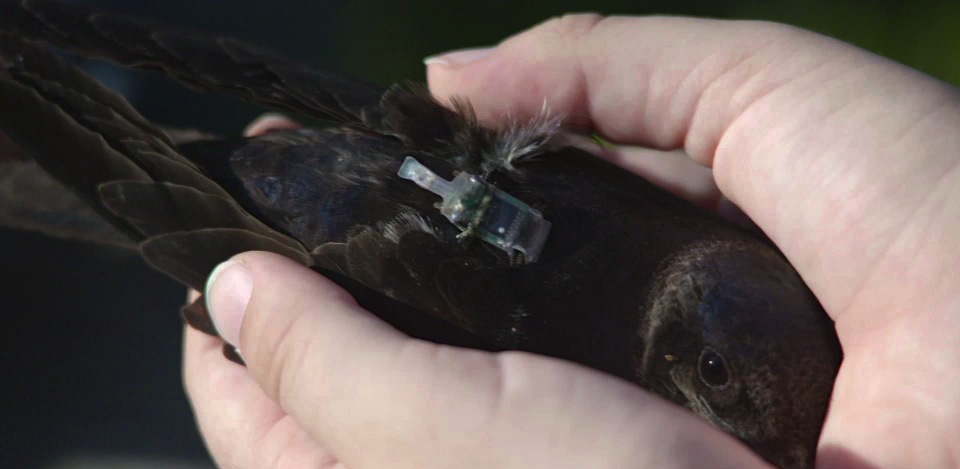
Bridget Stutchbury is tracking songbirds with cutting-edge technology: tiny light-level logging geolocators.
Every July, Bridget and her team band the birds with the geolocators and these tiny devices become luggage on the birds’ expansive migratory journey, recording light levels from the sun every two minutes, twenty-four hours per day. The technology translates sunrise and sunset times into longitude and latitude so Bridget knows where the bird was when.
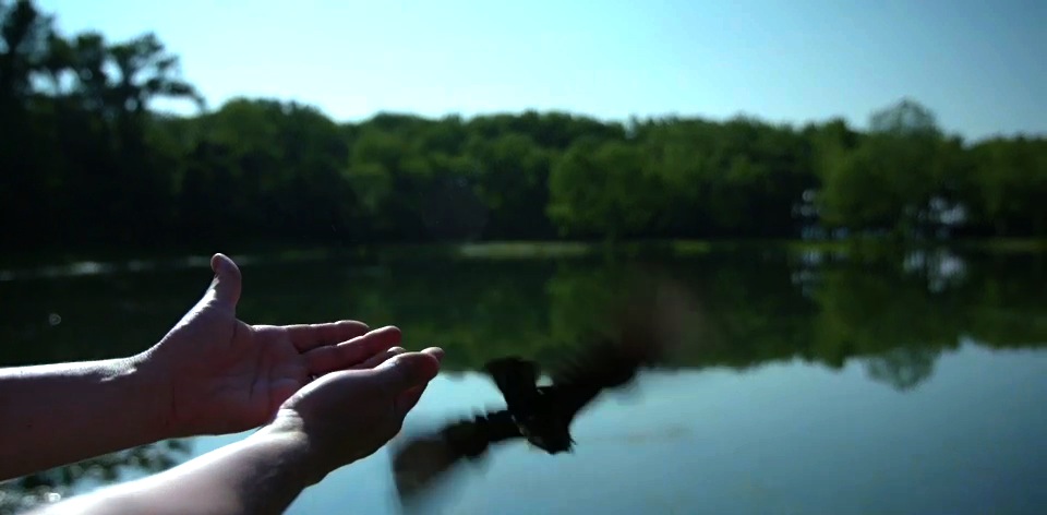
These devices don’t send data, they store it, so to learn anything Bridget needs to get the geolocators back. This coming May Bridget will be in Erie, PA to remove geolocators from the birds she banded ten months earlier.
Last July the SongbirdSOS team was with Bridget when she banded the purple martins that were on their way south. She talked about the surprising results she has collected so far. “We’ve seen birds that have travelled from Pennsylvania to the Gulf Coast in only two days.” That’s 1300 kilometres.
Bridget thinks this data will shake up ornithologists’ models for songbird migration patterns. These birds are flying much faster than she ever thought they could fly. She thinks it may have to do with stiff competition over mates and nest sights.
Understanding the timing of the Purple Martin’s migration route is critical – with climate change altering the timing of the seasons, the survival of the species is at risk. “Climate change is a new threat for songbirds,” says Bridget. “Some of our studies will show that they’re going to have trouble timing their migration to match the changes from one spring to the next. It’s not very good news for some of these songbirds.”